I’m releasing a couple of small updates to my ortho pack. Both of these affect the upper region of the South Island.
The first is some cloud removal from around the Tasman region. The download is here, simply overwrite the files in the texture folder of the tile listed in the name.
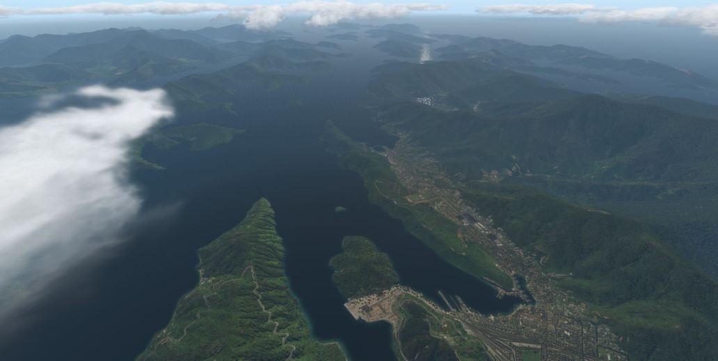
The second is adjusting the shore line around Picton and the Sounds. The download for this tile is here.
Finally, a small update on the distribution. My torrent client is reporting that I’ve uploaded 750GB over the past 5 days! That’s a huge amount of data. I hope I don’t get a nasty email from my ISP! It sure is good to have unlimited ultra fast broadband internet, thanks to a successful government roll out of fibre-to-the-door.
As before, if you’ve downloaded the ortho and find it useful, please donate!
Categories: Flight Simulation
 New airport: NZKM Karamea
  Planting seeds
  Landing now: Lyndiman NZ Ortho 2025 is now available.
  Sounds like a good idea
Thank you again for the patches 🙂
Wow, thats quick, I’lll have to go back to Picton……
From Omaka down the coast this afternoon via Kaikoura to Christchurch. Great trip following State Highway all the way, only blemish I could find is one tile, Kaikoura itself, the square sticks out as it has the vivid colour treatment the rest of the country side felt like I were actually driving down, even seen our normal stopping places on the way down.
May I ask, do you hand draw the highways or do use a programme that does it for you ?
Reason I’m curious is that in places the highway is perfectly placed and others it is up on stilts.
As I say I’m curious because if you have hand drawn them you have more patience than me.
Where is the issue at Kaikoura? The imagery comes from a mosaic of aerial photographs. I don’t see any colour issue at Kaikoura – this is how I see it: http://imgur.com/a/PS07E
I have a zipped photo for you which shows it very well, can you let me know your email address and I’ll send it to you. Can’t see any way to attach here and I don’t have a twitter account.
You can contact me at wichid at gmail. Or drop it into imgur.com and send me the link. ta.
Hi great reading yoour blog