Sometimes using the latest and highest quality images aren’t the best thing to do. Check out the current imagery for Napier, for example. It is at a resolution of .3M and taken around 2015, but you’ll see that it appears to be in a serious drought (I think most aerial photography is taken during summer).
Here’s a look at Napier in the current release:
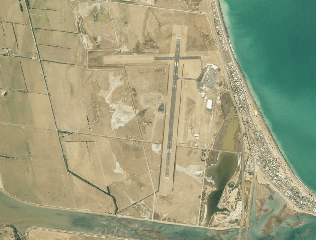
That looks like it could be from the Persian Gulf, and here’s what it will look like in the next release:
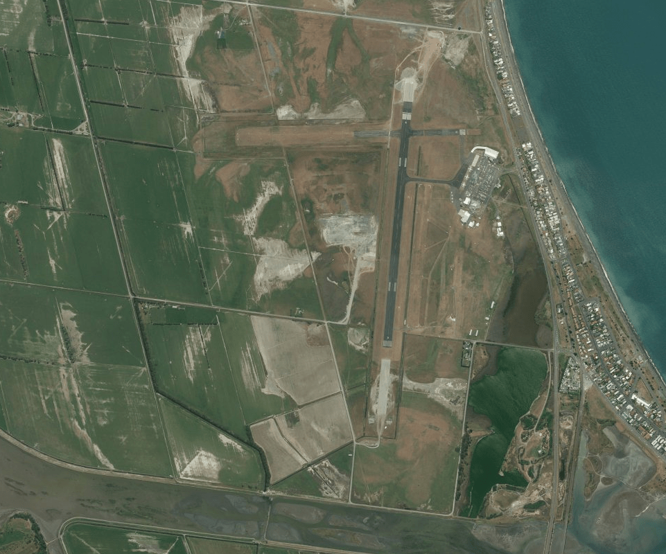
This is older imagery, from about 2011, but i think it’s much more representative of the area. What do you think?
Categories: Flight Simulation
 New airport: NZKM Karamea
  Planting seeds
  Landing now: Lyndiman NZ Ortho 2025 is now available.
  Sounds like a good idea
Nice, love it!
Much better than the Dubai lookalike we currently operate from -)
Only slight drawback is the lack of the (large) buildings that went up post-2011. Oh, and the new access road that’s going in… I could go on… but it all goes out of date eventually.
Thanks!